


2025-12-15
11 min read
Mount Everest is the tallest mountain in the entire world, with a sickening height of 29,032 feet (8,849 meters) above sea level. However, where is Mount Everest located? The solution lies in the complex geography of the Himalayas and in the boundaries of the two countries that both claim the natural miracle. When you are asking the question, " Where is Mount Everest Located? " or when you are searching for Mount Everest's location, this entire guide is everything you are going to know in terms of the geographical location of Mount Everest.
Mount Everest is located in Nepal and Tibet, in the eastern Himalayas. These two territories share the mountain that forms the international border between them, making it a common treasure of both states. When an individual questions whether Mount Everest is in Nepal, the answer is partly true: the mountain lies within Nepal on one side, whereas on the other side it belongs to Tibet. The majority of mountaineers heading for Mount Everest enter the mountain via the South Col route in Nepal, while a few use the North Col route, which is the more difficult route on the Tibetan side.
The actual position of this mountain is at about 27.9881° North and 86.9250° East. The remote location at the center of Asia makes Mount Everest one of the most challenging mountains on Earth to climb, but thousands of people try to reach the top every year. The coordinates of Mount Everest also ensure that it is situated in one of the most inaccessible territories in the world.
The mountain system does not consist of Mount Everest. The mountain is a sub-range of the Mahalangur Himal of the greater Himalayas. This chain of mountains cuts across five countries: Nepal, Tibet, Bhutan, India, and Pakistan. The Himalayas are the world's highest mountain system, with Mount Everest as its highest peak.
When discussing the location of Mount Everest in the Himalayas, scientists refer to the mountain's crucial role within the range. Mount Everest lies in one of the most geologically active areas on Earth because of the Himalayas' position. This incredible mountain range was formed by the collision of the Indian and Eurasian tectonic plates millions of years ago. The change in Mount Everest's height can be attributed to the same geological forces that, to date, have affected the mountain's height and structure.
This geographic reality has the geographic border between Nepal and Tibet running directly across the top of Mount Everest. It is thus an essential part of the background of learning the location of Mount Everest. Such a location of the border implies that both countries have valid claims to the mountain. Nepal calls the peak Sagarmatha in Nepali, whereas Tibet and China call it Chomolungma, a Tibetan-language name meaning the goddess Mother of the World.
The most popular route for climbing Everest is the Nepal side. Most climbers aiming to climb Mount Everest in Nepal use the South Col route. In the meantime, the other option is the North Col route on Mount Everest, either the Tibet or China side. The location of the borders poses intriguing diplomatic challenges for mountaineers seeking to reach the summit of Mount Everest.
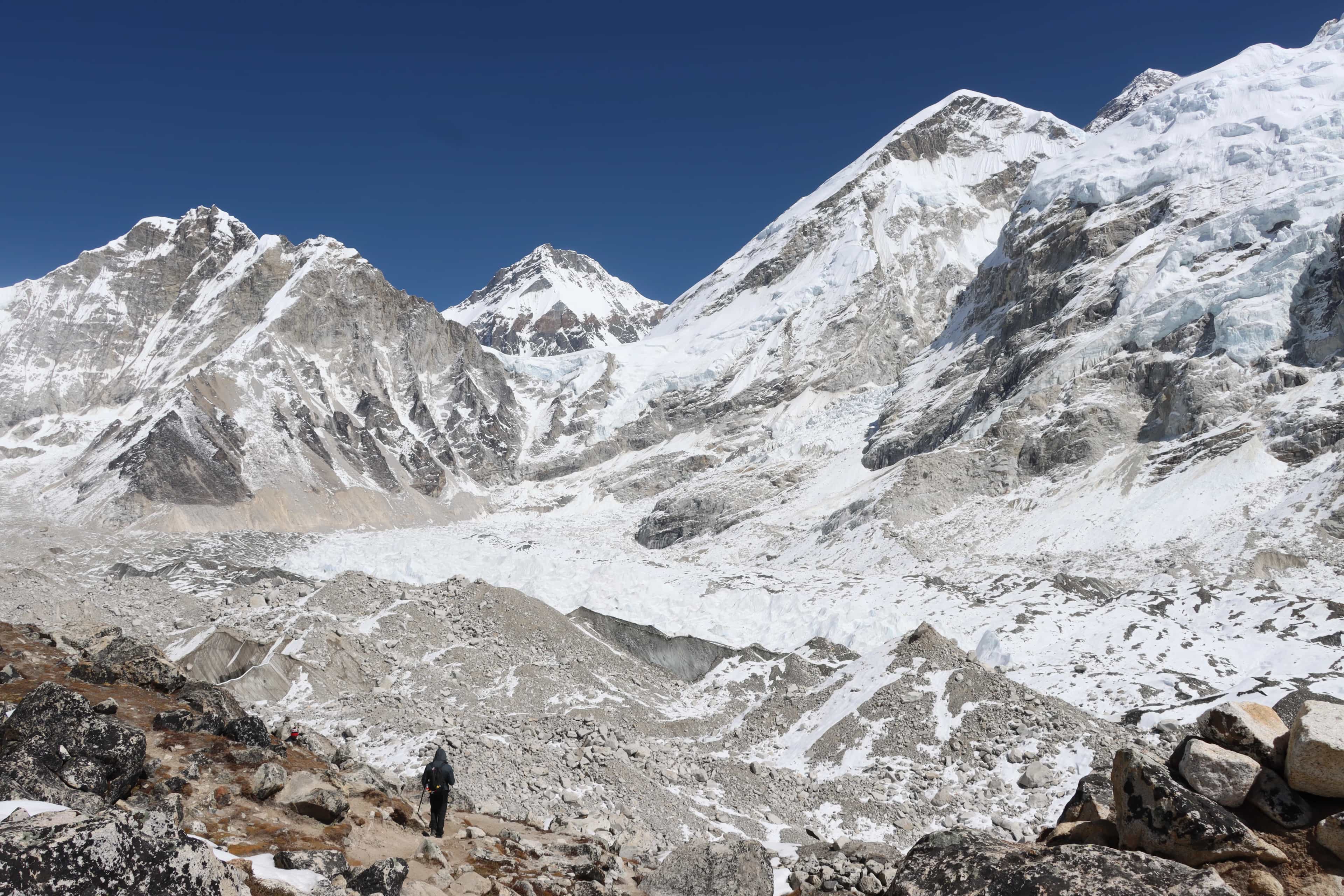
Khumbu, the region in Nepal where the southern approach to Mount Everest begins, is home to some of the most spectacular mountain landscapes in the world. This area is the access point to climbing Mount Everest in Nepal. Other mountains surrounding it are Lhotse, the fourth-highest mountain in the world, and Nuptse, which lies in the valley where climbers set up base camp.
The Nepal side of Mount Everest base camp south is at 17,598 feet (5,364 meters) and is therefore an important starting point for attempting to reach the summit. The trip between Kathmandu and Everest Base Camp South is estimated to take two weeks of walking through the Khumbu Valley. Namche Bazaar, at an altitude of 11,286 feet (3,440 meters), is the major trading center of the Khumbu region and supplies essential supplies to climbers before they embark on their Mount Everest expedition.
Remote settlements can surround Mount Everest. Sherpas are people from the Khumbu region who have been associated with expeditions to Mount Everest. These experienced mountaineers guide those trying to reach the top of Mount Everest, and their experience navigating the high-altitude mountain passes spans generations.
Khumbu, the region in Nepal where the southern approach to Mount Everest begins, is home to some of the most spectacular mountain landscapes in the world. This area is the access point to climbing Mount Everest in Nepal. Other mountains surrounding it are Lhotse, the fourth-highest mountain in the world, and Nuptse, which lies in the valley where climbers set up base camp.
The Nepal side of Mount Everest base camp south is at 17,598 feet (5,364 meters) and is therefore an important starting point for attempting to reach the summit. The trip between Kathmandu and Everest Base Camp South is estimated to take two weeks of walking through the Khumbu Valley. Namche Bazaar, at an altitude of 11,286 feet (3,440 meters), is the major trading center of the Khumbu region and supplies essential supplies to climbers before they embark on their Mount Everest expedition.
Remote settlements can surround Mount Everest. Sherpas are a people located in the Khumbu region and are associated with the expeditions to Mount Everest. These experienced mountaineers guide those trying to reach the top of Mount Everest, and their experience navigating the high-altitude mountain passes spans generations.
Knowledge of various routes to Mount Everest is required. If you wish to hike Mount Everest or even visit Mount Everest Base Camp, it is essential to understand the routes to the mountain. The majority of climbers who use the trail markings on Mount Everest set out on their journey in Kathmandu, Nepal, which is considered the main entry point to the mountain.
The most common route to Mount Everest in Nepal is through the Khumbu Valley to the base camp, South of Mount Everest. This is the style used in the standard Mount Everest South Col ascent, in which climbers use pre-existing tracks that lead to teahouses offering overnight accommodation. The South Col route is the most straightforward approach to Mount Everest when a person asks themself how to get up the mountain.
Alternatively, climbers who intend to climb Mount Everest via the North Col route must obtain the Tibet and Chinese permits. The North route of Mount Everest requires additional logistical planning, and the terrain presents different challenges. Climbing routes of Mount Everest vary considerably between the north and south.
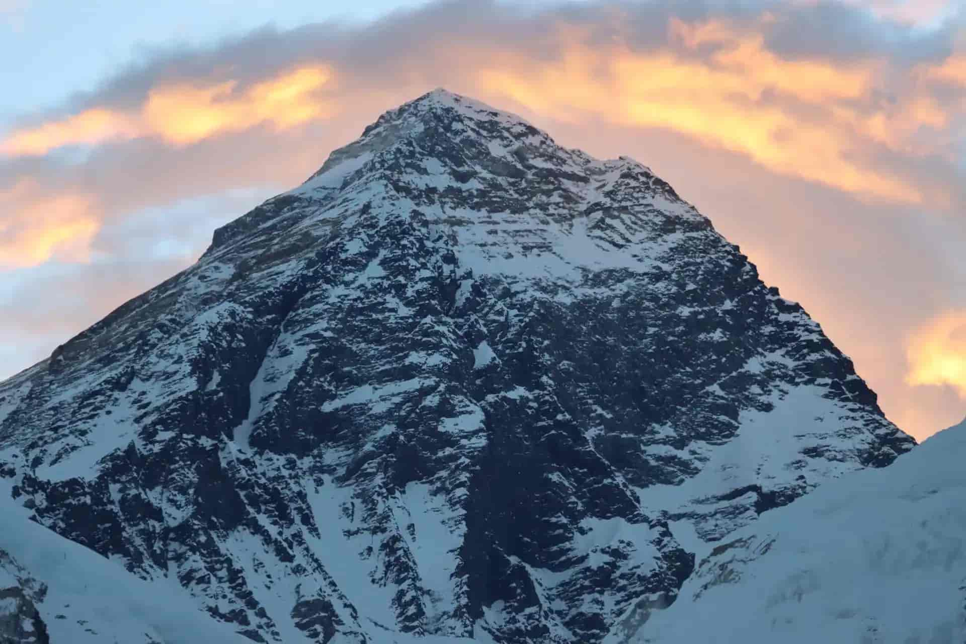
The elevation of Mount Everest is 29,032 feet (8,849 meters), though its height is still being measured. The height of Mount Everest is so high that it is the highest mountain in the world and beats all other mountains by a wide margin. The precise altitude of Mount Everest has also been measured and agreed internationally.
The South Base Camp for climbers is at about 11,434 feet, and climbers need proper acclimatization to overcome the effects of high altitude on Mount Everest. Mount Everest altitude sickness poses severe challenges that require extensive preparation by climbers. Knowledge of Mount Everest's extreme altitude helps explain why climbing it is among the riskiest mountaineering activities in the world.
Mount Everest's location in the Himalayas exposes it to certain climatic zones influenced by monsoon systems and the jet stream. The weather conditions on Mount Everest vary drastically around the year, and the spring and fall seasons present the best conditions under which Mount Everest climbing can take place. The mountain's location exposes it to the humid winds of the Indian Ocean.
Avalanches are frequent on the south side of Mount Everest due to snowfall, which the climbers will have to overcome. The temperature on Mount Everest decreases significantly with altitude, reaching a fatal level at the peak, where it drops to -40 degrees Fahrenheit and even lower. Knowledge of Mount Everest's weather windows is essential for planning expeditions.
Climbing Mount Everest is most likely during specific seasonal periods when weather conditions are most predictable. The period of Mount Everest climbing activities usually includes spring-season expeditions in May and autumn-season expeditions in September and October. These examples of timeframes used during the season to climb Mount Everest show the direct impact that geography has on mountaineering and the likelihood of reaching the summit.
Mount Everest has a profound cultural implication for the people in the region. Mount Everest in Nepal is a sacred point, especially to the Sherpas. In Tibetan culture, Mount Everest is a spiritual residence of gods, and Buddhist monasteries and prayer flags are scattered across the land.
The religious significance of Mount Everest shapes how Mount Everest missions operate in this culturally sensitive area. Mount Everest's sacredness is an expression of stronger ties between the mountain's geographical features and the people inhabiting its shadow.
In case you want to go to Mount Everest or climb it, a knowledge of its location will prepare you to do so. The most common way to reach Mount Everest starts with the international flights to Nepal or Tibet. The main access point to Mount Everest is Kathmandu, Nepal, the entry point for most climbers.
The process of reaching Mount Everest from Kathmandu involves several flights to smaller airstrips, road travel, and a long trek. The ability to access Mount Everest has been enhanced by improved transportation systems, though it still takes significant time and physical conditioning. To visit Mount Everest, one needs months of planning and proper acclimatization.
Environmental change has been observed at Mount Everest, influencing the geography and weather conditions for climbing. The effects of climate change on Mount Everest are more evident in the changing conditions of snow and ice. Over the past decades, glaciers on Mount Everest have been receding drastically due to rising temperatures in the Himalayan region.
Refluxing of tectonic plates is also known to modify the precise height and the geographical location of Mount Everest. Each year, Mount Everest increases in height due to geological events, adding millimeters. This dynamic geography implies that Mount Everest is not a fixed landmark but a changing landscape.
Several Mount Everest facts concern the mountain's location and geography. The distance from Mount Everest to big cities such as Kathmandu is about 200 kilometers. The coordinates of Mount Everest have been determined for hundreds of years, using new survey methods.
Mount Everest's geographical phenomenon is not restricted only to mountaineering. On a clear day, Mount Everest can be seen from more than a hundred kilometers away. The way Mount Everest looks is unique enough to be recognized even in a picture taken far away.
It is essential to plan well whether one wants to climb Mount Everest or even explore Mount Everest Base Camp. Permit requirements for Mount Everest vary depending on the approach to the mountain. The guides on the Mount Everest trek assist visitors in navigating safely and with dignity.
Mount Everest tour packages offer structured ways to see the mountain without the responsibility of mountaineering. Some of the tips in the Mount Everest travel guide include taking time to acclimatize and carrying the right equipment. Tourism on Mount Everest has increased tremendously, and the mountain has become more accessible at the expense of environmental and safety issues.
Mount Everest is located on the Nepal-Tibet border in the eastern Himalayas, at 27.9881° North and 86.9250° East. This post influences all aspects of mountaineering expeditions to the summit of the world. Where is Mount Everest is a question whose answer yields both a specific location and transcendence.
The location of Mount Everest dictates the access routes, weather conditions, cultural experiences, and logistical challenges that climbers encounter. The experience of climbing the mountain depends on its location, whether on the Nepal side or the Rongbuk Valley side in Tibet, a remote area. This knowledge of Mount Everest's geographical location helps aspiring climbers, curious tourists, and geography lovers appreciate that it is a revered and intriguing mountain.
The spot of Mount Everest is no less important than its height, and it is really the most impressive spot on Earth. To those who ask, "Where is Mount Everest located?" the answer is like a window into one of humanity's most outstanding achievements in mountaineering and one of the most impressive natural phenomena.
+
+
+
+
+
+
+
+
+
+
© 2026 5k Treks Pvt. Ltd. All rights reserved.
